

A few dreary days before our "Arctic Blast"
KMSP Minneapolis, MN - The weather albatross this week will be the arrival of our first arctic blast of the season. The cold will arrive this weekend, but before the mercury takes a plunge, we will hover through a few days of gloomy weather. This three step transition back to a hearty Minnesota winter is well on its way.
LIGHT SNOW FOR MINNESOTA
Our next weather maker will move in for the southwest. This low will struggle for strength as is drifts to the Northeast, resulting in a few chances of precipitation for the Upper Midwest. The first chance of precipitation will arrive late Wednesday. Our approaching weather system will spread in some mild and moist air, squeezing out a few flakes in the process.

CLOUDS, FOG & MIST
After the initial shot of snow from our mild up, we then sit quiet for a few days as we wait for the next big change. However, this temporary time-out will be far from fun, as the warm moist air in place will result in a gloomy and possible foggy period. Areas of Minnesota and Wisconsin that lucked out in the snow cover department will see the best chance of low clouds and fog as this blanket of white cools the lingering moisture into a not so pleasant fog and mist.

This situation can lead to troubles of its own as the mist can freeze on area roadways, so take it easy.
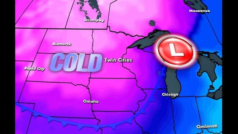
THE BIG CHILL

The third part of this big change will come as our system winds up and pulls off to the East. This exodus could result in another chance of light snow as the colder air wraps into Minnesota and Wisconsin. Then, as we head into the weekend, the gates are open for the coldest air of the season to pour into the area. The good news is that this cold and dry area of high pressure will clear the air and lead to tons of sun. However, the bad news is that the sun will do little to warm us up as the coldest air this season will have a firm grip on Minnesota.