

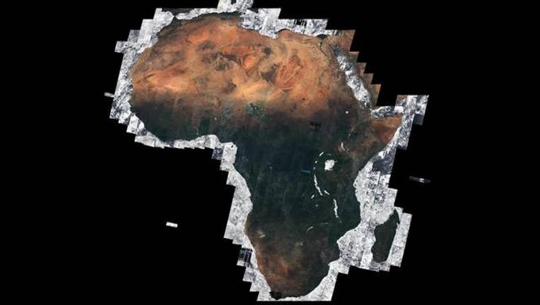
Africa seen cloud free for the first time
KMSP - No, it’s not something from the movie Day After Tomorrow where the entire atmosphere has a remarkable transformation and completely clears out to nothing but blue skies. It’s a satellite and 5 months of flyovers.
The European Space Agencies’ new satellite Sentinel-2A took almost 7000 pictures over the course of nearly 5 months to complete the composite image and give us a glimpse at the entire continent of Africa cloud free for the first time. What makes this feat especially difficult is that Africa runs through the Equator and the Intertropical Convergence Zone (ITCZ). The ITCZ is the most active sector of the planet bringing hundreds of inches of rain to the areas it resides every year making it nearly impossible to see the ground. But the new satellite rotates around the Equator every 10 days, a pretty short period for a high resolution satellite giving it plenty of chances to capture every square inch of the continent.
(The picture above is courtesy of the Copernicus Sentinel data as well as Brockmann Consult/ Université catholique de Louvain as part of ESA’s Climate Change Initiative Land Cover project)